


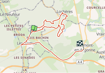
Locheres

Divio
User

Length
19.9 km

Max alt
296 m

Uphill gradient
417 m
Km-Effort
25 km

Min alt
161 m

Downhill gradient
356 m
Boucle
No
Creation date :
2019-08-27 06:36:51.447
Updated on :
2019-08-27 09:38:44.814
3h01
Difficulty : Very easy

FREE GPS app for hiking
 SityTrail
IGN / Geographical institutes
SityTrail Plus
The world is yours!
About
Trail Walking of 19.9 km to be discovered at Grand Est, Meuse, Les Islettes. This trail is proposed by Divio.
Positioning
Country:
France
Region :
Grand Est
Department/Province :
Meuse
Municipality :
Les Islettes
Location:
Unknown
Start:(Dec)
Start:(UTM)
646427 ; 5442380 (31U) N.
Comments